 Ambassador
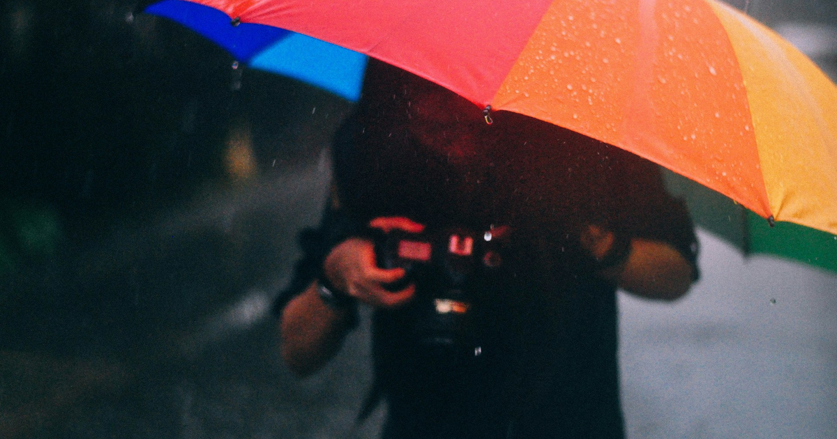
 Sander Meijer<p>We went on a short hike above Reichenbach im Kiental, Switzerland. The lighting was very difficult for taking pictures (or the photographer was not good enough), so I had to zoom in a lot to get the (my) best pictures. </p><p>Since it won't take long anymore before the snow is fully gone, took the opportunity to take some close-ups from mountains.</p><p><a href="https://mountains.social/tags/Hiking" class="mention hashtag" rel="nofollow noopener" target="_blank">#<span>Hiking</span></a> <a href="https://mountains.social/tags/WeeklyHikingPicture" class="mention hashtag" rel="nofollow noopener" target="_blank">#<span>WeeklyHikingPicture</span></a> <a href="https://mountains.social/tags/Mountains" class="mention hashtag" rel="nofollow noopener" target="_blank">#<span>Mountains</span></a> <a href="https://mountains.social/tags/Lobh%C3%B6rner" class="mention hashtag" rel="nofollow noopener" target="_blank">#<span>Lobhörner</span></a> <a href="https://mountains.social/tags/Dreispitz" class="mention hashtag" rel="nofollow noopener" target="_blank">#<span>Dreispitz</span></a> <a href="https://mountains.social/tags/Gehrihorn" class="mention hashtag" rel="nofollow noopener" target="_blank">#<span>Gehrihorn</span></a> <a href="https://mountains.social/tags/%C3%84rmighore" class="mention hashtag" rel="nofollow noopener" target="_blank">#<span>Ärmighore</span></a> <a href="https://mountains.social/tags/Reichenbach" class="mention hashtag" rel="nofollow noopener" target="_blank">#<span>Reichenbach</span></a></p>
photog.social is one of the many independent Mastodon servers you can use to participate in the fediverse.
🌈 An inclusive place for your photos, silliness, and convos! 🌈
Administered by:
Server stats:
238active users
photog.social: About · Profiles directory · Privacy policy
Mastodon: About · Get the app · Keyboard shortcuts · View source code · v4.4.8
#weeklyhikingpicture
0 posts · 0 participants · 0 posts today
Sander Meijer<p>Late entry for <a href="https://mountains.social/tags/MountainMonday" class="mention hashtag" rel="nofollow noopener" target="_blank">#<span>MountainMonday</span></a>: Aiguille Verte (4122 m) near Chamonix, France.</p><p>A mountain like a child draws one.</p><p>Picture made from Le Brévent (2525 m) with Chamonix-Mont-Blanc in the valley.</p><p>🗓️ September 2007</p><p><a href="https://mountains.social/tags/AiguilleVerte" class="mention hashtag" rel="nofollow noopener" target="_blank">#<span>AiguilleVerte</span></a> <a href="https://mountains.social/tags/Chamonix" class="mention hashtag" rel="nofollow noopener" target="_blank">#<span>Chamonix</span></a> <a href="https://mountains.social/tags/Mountains" class="mention hashtag" rel="nofollow noopener" target="_blank">#<span>Mountains</span></a> <a href="https://mountains.social/tags/Hiking" class="mention hashtag" rel="nofollow noopener" target="_blank">#<span>Hiking</span></a> <a href="https://mountains.social/tags/WeeklyHikingPicture" class="mention hashtag" rel="nofollow noopener" target="_blank">#<span>WeeklyHikingPicture</span></a></p>
Sander Meijer<p>Bällehöchst (2095m) is a mountain in the Bernese Oberland with a fantastic panorama from Lake Brienz (on the left) to the 4000+ mountains (on the right). </p><p>Went there for a sunrise hike but was 5 minutes late 😅, but at least I was alone on the summit. The clouds in the Lütschental were performing a slow wave, sort of mesmerizing. </p><p><a href="https://map.geo.admin.ch/?lang=en&topic=ech&bgLayer=ch.swisstopo.pixelkarte-farbe&layers=ch.swisstopo.zeitreihen,ch.bfs.gebaeude_wohnungs_register,ch.bav.haltestellen-oev,ch.swisstopo.swisstlm3d-wanderwege,ch.astra.wanderland-sperrungen_umleitungen&layers_opacity=1,1,1,0.8,0.8&layers_visibility=false,false,false,false,false&layers_timestamp=18641231,,,,&E=2632191.48&N=1164595.85&zoom=11" rel="nofollow noopener" translate="no" target="_blank"><span class="invisible">https://</span><span class="ellipsis">map.geo.admin.ch/?lang=en&topi</span><span class="invisible">c=ech&bgLayer=ch.swisstopo.pixelkarte-farbe&layers=ch.swisstopo.zeitreihen,ch.bfs.gebaeude_wohnungs_register,ch.bav.haltestellen-oev,ch.swisstopo.swisstlm3d-wanderwege,ch.astra.wanderland-sperrungen_umleitungen&layers_opacity=1,1,1,0.8,0.8&layers_visibility=false,false,false,false,false&layers_timestamp=18641231,,,,&E=2632191.48&N=1164595.85&zoom=11</span></a></p><p>🗓️ June 2020</p><p><a href="https://mountains.social/tags/MountainMonday" class="mention hashtag" rel="nofollow noopener" target="_blank">#<span>MountainMonday</span></a> <a href="https://mountains.social/tags/Hiking" class="mention hashtag" rel="nofollow noopener" target="_blank">#<span>Hiking</span></a> <a href="https://mountains.social/tags/B%C3%A4lleh%C3%B6chst" class="mention hashtag" rel="nofollow noopener" target="_blank">#<span>Bällehöchst</span></a> <a href="https://mountains.social/tags/Mountains" class="mention hashtag" rel="nofollow noopener" target="_blank">#<span>Mountains</span></a> <a href="https://mountains.social/tags/WeeklyHikingPicture" class="mention hashtag" rel="nofollow noopener" target="_blank">#<span>WeeklyHikingPicture</span></a></p>
Sander Meijer<p>Feeling tiny.</p><p>🗓️ September, 2017</p><p><a href="https://mountains.social/tags/SilentSunday" class="mention hashtag" rel="nofollow noopener" target="_blank">#<span>SilentSunday</span></a> <a href="https://mountains.social/tags/Sessladspitze" class="mention hashtag" rel="nofollow noopener" target="_blank">#<span>Sessladspitze</span></a> <a href="https://mountains.social/tags/Tirol" class="mention hashtag" rel="nofollow noopener" target="_blank">#<span>Tirol</span></a> <a href="https://mountains.social/tags/Hiking" class="mention hashtag" rel="nofollow noopener" target="_blank">#<span>Hiking</span></a> <a href="https://mountains.social/tags/WeeklyHikingPicture" class="mention hashtag" rel="nofollow noopener" target="_blank">#<span>WeeklyHikingPicture</span></a></p>
Sander Meijer<p>Monte Gambarogno in Ticino, Switzerland with view over Lago Maggiore. There are several options to spend the night here.</p><p>🗓️ September 2021</p><p><a href="https://mountains.social/tags/MountainsMonday" class="mention hashtag" rel="nofollow noopener" target="_blank">#<span>MountainsMonday</span></a> <a href="https://mountains.social/tags/Hiking" class="mention hashtag" rel="nofollow noopener" target="_blank">#<span>Hiking</span></a> <a href="https://mountains.social/tags/MonteGambarogno" class="mention hashtag" rel="nofollow noopener" target="_blank">#<span>MonteGambarogno</span></a> <a href="https://mountains.social/tags/Mountains" class="mention hashtag" rel="nofollow noopener" target="_blank">#<span>Mountains</span></a> <a href="https://mountains.social/tags/MountainMonday" class="mention hashtag" rel="nofollow noopener" target="_blank">#<span>MountainMonday</span></a> <a href="https://mountains.social/tags/WeeklyHikingPicture" class="mention hashtag" rel="nofollow noopener" target="_blank">#<span>WeeklyHikingPicture</span></a></p>
Sander Meijer<p>As I'm on-call duty this week, I had to stay closer to home. But this was not a downside as currently everywhere you look, it is just magnificent. 😍 </p><p>We went on a small "hike" on the Spiezberg overlooking Lake Thun. The location of the first picture (the panorama) is also my favorite location in the village for sunrise views. </p><p><a href="https://mountains.social/tags/Hiking" class="mention hashtag" rel="nofollow noopener" target="_blank">#<span>Hiking</span></a> <a href="https://mountains.social/tags/WeeklyHikingPicture" class="mention hashtag" rel="nofollow noopener" target="_blank">#<span>WeeklyHikingPicture</span></a> <a href="https://mountains.social/tags/Spiez" class="mention hashtag" rel="nofollow noopener" target="_blank">#<span>Spiez</span></a> <a href="https://mountains.social/tags/Mountains" class="mention hashtag" rel="nofollow noopener" target="_blank">#<span>Mountains</span></a></p>
Sander Meijer<p>Although we knew better, we tried to walk to Usserberg (1592 m) in the Saxettal. After climbing from Saxeten (1102 m) roughly 200 meters we called it quits, as there was just too much snow. We walked back to Saxeten and chose the Saxetbach trail, which still had snow, but was much flatter so it was an easy walk. The fresh air was nice.</p><p><a href="https://mountains.social/tags/Hiking" class="mention hashtag" rel="nofollow noopener" target="_blank">#<span>Hiking</span></a> <a href="https://mountains.social/tags/WeeklyHikingPicture" class="mention hashtag" rel="nofollow noopener" target="_blank">#<span>WeeklyHikingPicture</span></a> <a href="https://mountains.social/tags/Saxeten" class="mention hashtag" rel="nofollow noopener" target="_blank">#<span>Saxeten</span></a></p>
Sander Meijer<p>I came across this fine example of a non-standard Swiss fingerpost in June. It leads to a wooden footbridge overlooking the forest on the Gägger. </p><p>"The storm of the century", Lothar, almost completely destroyed the forest at the end of 1999. That part of the forest will now be left alone to develop entirely naturally (which can be followed from the footbridge).</p><p><a href="https://www.gantrisch.ch/entdecken/aktivitaeten/zu-fuss/gaeggersteg/" rel="nofollow noopener" translate="no" target="_blank"><span class="invisible">https://www.</span><span class="ellipsis">gantrisch.ch/entdecken/aktivit</span><span class="invisible">aeten/zu-fuss/gaeggersteg/</span></a></p><p><a href="https://mountains.social/tags/FingerpostFriday" class="mention hashtag" rel="nofollow noopener" target="_blank">#<span>FingerpostFriday</span></a> <a href="https://mountains.social/tags/Hiking" class="mention hashtag" rel="nofollow noopener" target="_blank">#<span>Hiking</span></a> <a href="https://mountains.social/tags/WeeklyHikingPicture" class="mention hashtag" rel="nofollow noopener" target="_blank">#<span>WeeklyHikingPicture</span></a> <a href="https://mountains.social/tags/G%C3%A4ggersteg" class="mention hashtag" rel="nofollow noopener" target="_blank">#<span>Gäggersteg</span></a></p>
Sander Meijer<p>Came across a picture in my archive of the interior of the Leirvassbu Turisthytte. Really a cosy hut. I like to think this picture shows a dancefloor. 🕺 </p><p><a href="https://mountains.social/tags/MountainHuts" class="mention hashtag" rel="nofollow noopener" target="_blank">#<span>MountainHuts</span></a> <a href="https://mountains.social/tags/Hiking" class="mention hashtag" rel="nofollow noopener" target="_blank">#<span>Hiking</span></a> <a href="https://mountains.social/tags/WeeklyHikingPicture" class="mention hashtag" rel="nofollow noopener" target="_blank">#<span>WeeklyHikingPicture</span></a> <a href="https://mountains.social/tags/Jotunheimen" class="mention hashtag" rel="nofollow noopener" target="_blank">#<span>Jotunheimen</span></a> <a href="https://mountains.social/tags/Leirvassbu" class="mention hashtag" rel="nofollow noopener" target="_blank">#<span>Leirvassbu</span></a></p>
Sander Meijer<p>Lonely afternoon hike to Trollhøe (1'348m), Jotunheimen National Park, Norway. </p><p>🗓️ July 2016</p><p><a href="https://mountains.social/tags/ThrowbackThursday" class="mention hashtag" rel="nofollow noopener" target="_blank">#<span>ThrowbackThursday</span></a> <a href="https://mountains.social/tags/Hiking" class="mention hashtag" rel="nofollow noopener" target="_blank">#<span>Hiking</span></a> <a href="https://mountains.social/tags/WeeklyHikingPicture" class="mention hashtag" rel="nofollow noopener" target="_blank">#<span>WeeklyHikingPicture</span></a> <a href="https://mountains.social/tags/Trollh%C3%B8e" class="mention hashtag" rel="nofollow noopener" target="_blank">#<span>Trollhøe</span></a> <a href="https://mountains.social/tags/Jotunheimen" class="mention hashtag" rel="nofollow noopener" target="_blank">#<span>Jotunheimen</span></a></p>
Sander Meijer<p>This picture is from the first "hike" of my daughter. We went up to Planplatten (above Meiringen, Switzerland) by cablecar where she stepped around a bit. Afterwards we hiked down with her in the baby carrier. In the background you can see the Bernese Oberland, with amongst others the Wetterhorn.</p><p>🗓 September 2006</p><p><a href="https://mountains.social/tags/ThrowbackThursday" class="mention hashtag" rel="nofollow noopener" target="_blank">#<span>ThrowbackThursday</span></a> <a href="https://mountains.social/tags/Hiking" class="mention hashtag" rel="nofollow noopener" target="_blank">#<span>Hiking</span></a> <a href="https://mountains.social/tags/WeeklyHikingPicture" class="mention hashtag" rel="nofollow noopener" target="_blank">#<span>WeeklyHikingPicture</span></a> <a href="https://mountains.social/tags/Planplatten" class="mention hashtag" rel="nofollow noopener" target="_blank">#<span>Planplatten</span></a></p>
Sander Meijer<p>Still did not have the opportunity to really go out into the mountains, but did manage to go on a small hike on Bürgberg. From there you have a nice view on Faulensee and the Bernese Oberland.</p><p><a href="https://mountains.social/tags/Hiking" class="mention hashtag" rel="nofollow noopener" target="_blank">#<span>Hiking</span></a> <a href="https://mountains.social/tags/WeeklyHikingPicture" class="mention hashtag" rel="nofollow noopener" target="_blank">#<span>WeeklyHikingPicture</span></a> <a href="https://mountains.social/tags/Faulensee" class="mention hashtag" rel="nofollow noopener" target="_blank">#<span>Faulensee</span></a> <a href="https://mountains.social/tags/Niesen" class="mention hashtag" rel="nofollow noopener" target="_blank">#<span>Niesen</span></a> <a href="https://mountains.social/tags/BernerOberland" class="mention hashtag" rel="nofollow noopener" target="_blank">#<span>BernerOberland</span></a> <a href="https://mountains.social/tags/BerneseOberland" class="mention hashtag" rel="nofollow noopener" target="_blank">#<span>BerneseOberland</span></a> <a href="https://mountains.social/tags/SBB" class="mention hashtag" rel="nofollow noopener" target="_blank">#<span>SBB</span></a></p>
Sander Meijer<p>Yesterday was a beautiful day, but was not able to get out. If I had, it probably would have looked a lot like this.</p><p>Justistal with view towards Schibe (1'955m) with the Sichle-pass (1'679m) to the left.</p><p>🗓️ December 2020</p><p><a href="https://map.geo.admin.ch/?lang=en&topic=ech&bgLayer=ch.swisstopo.pixelkarte-farbe&layers=ch.swisstopo.zeitreihen,ch.bfs.gebaeude_wohnungs_register,ch.bav.haltestellen-oev,ch.swisstopo.swisstlm3d-wanderwege,ch.astra.wanderland-sperrungen_umleitungen&layers_opacity=1,1,1,0.8,0.8&layers_visibility=false,false,false,false,false&layers_timestamp=18641231,,,,&E=2627016.00&N=1175217.00&zoom=9" rel="nofollow noopener" translate="no" target="_blank"><span class="invisible">https://</span><span class="ellipsis">map.geo.admin.ch/?lang=en&topi</span><span class="invisible">c=ech&bgLayer=ch.swisstopo.pixelkarte-farbe&layers=ch.swisstopo.zeitreihen,ch.bfs.gebaeude_wohnungs_register,ch.bav.haltestellen-oev,ch.swisstopo.swisstlm3d-wanderwege,ch.astra.wanderland-sperrungen_umleitungen&layers_opacity=1,1,1,0.8,0.8&layers_visibility=false,false,false,false,false&layers_timestamp=18641231,,,,&E=2627016.00&N=1175217.00&zoom=9</span></a></p><p><a href="https://mountains.social/tags/MountainMonday" class="mention hashtag" rel="nofollow noopener" target="_blank">#<span>MountainMonday</span></a> <a href="https://mountains.social/tags/Hiking" class="mention hashtag" rel="nofollow noopener" target="_blank">#<span>Hiking</span></a> <a href="https://mountains.social/tags/WeeklyHikingPicture" class="mention hashtag" rel="nofollow noopener" target="_blank">#<span>WeeklyHikingPicture</span></a> <a href="https://mountains.social/tags/Justistal" class="mention hashtag" rel="nofollow noopener" target="_blank">#<span>Justistal</span></a></p>
Sander Meijer<p>Lake Louise, known for its milky light-blue water, as seen from the Beehive.</p><p>🗓️ August 2012</p><p><a href="https://mountains.social/tags/ThrowbackThursday" class="mention hashtag" rel="nofollow noopener" target="_blank">#<span>ThrowbackThursday</span></a> <a href="https://mountains.social/tags/Hiking" class="mention hashtag" rel="nofollow noopener" target="_blank">#<span>Hiking</span></a> <a href="https://mountains.social/tags/WeeklyHikingPicture" class="mention hashtag" rel="nofollow noopener" target="_blank">#<span>WeeklyHikingPicture</span></a> <a href="https://mountains.social/tags/LakeLouise" class="mention hashtag" rel="nofollow noopener" target="_blank">#<span>LakeLouise</span></a> <a href="https://mountains.social/tags/Beehive" class="mention hashtag" rel="nofollow noopener" target="_blank">#<span>Beehive</span></a></p>
Sander Meijer<p>The Chrüzhütte (1'718m) in the Urner Alps, Switzerland is probably the hut which reminded me the most of Hansel and Gretel. When we arrived there was a very large group of fanfare musicians, that we celebrating some anniversary of their music club. </p><p>They walked up the 800 meters to the hut with their instruments and played at the hut, making it a serious party. </p><p>Late afternoon they descended by cable car and left the hut behind in quite a different situation: quiet and foggy.</p><p>🗓️ September 2021</p><p><a href="https://mountains.social/tags/MountainHuts" class="mention hashtag" rel="nofollow noopener" target="_blank">#<span>MountainHuts</span></a> <a href="https://mountains.social/tags/Hiking" class="mention hashtag" rel="nofollow noopener" target="_blank">#<span>Hiking</span></a> <a href="https://mountains.social/tags/WeeklyHikingPicture" class="mention hashtag" rel="nofollow noopener" target="_blank">#<span>WeeklyHikingPicture</span></a> <a href="https://mountains.social/tags/Chr%C3%BCzh%C3%BCtte" class="mention hashtag" rel="nofollow noopener" target="_blank">#<span>Chrüzhütte</span></a></p>
Sander Meijer<p>Hard day at the office. Time to relax with some good memories.</p><p>🗓️ July 2016</p><p><a href="https://mountains.social/tags/Hiking" class="mention hashtag" rel="nofollow noopener" target="_blank">#<span>Hiking</span></a> <a href="https://mountains.social/tags/WeeklyHikingPicture" class="mention hashtag" rel="nofollow noopener" target="_blank">#<span>WeeklyHikingPicture</span></a> <a href="https://mountains.social/tags/Preikestolen" class="mention hashtag" rel="nofollow noopener" target="_blank">#<span>Preikestolen</span></a> <a href="https://mountains.social/tags/Norway" class="mention hashtag" rel="nofollow noopener" target="_blank">#<span>Norway</span></a></p>
Sander Meijer<p>View from the Schibespitz (2'060m) towards the Gantrisch (2'176m), Bernese Alps. It is part of the so-called "Voralpen", the most northern part of the Alps. The flatter part of Switzerland is clearly visible.</p><p><a href="https://s.geo.admin.ch/a2f30e5be1" rel="nofollow noopener" translate="no" target="_blank"><span class="invisible">https://</span><span class="">s.geo.admin.ch/a2f30e5be1</span><span class="invisible"></span></a></p><p><a href="https://mountains.social/tags/MountainMonday" class="mention hashtag" rel="nofollow noopener" target="_blank">#<span>MountainMonday</span></a> <a href="https://mountains.social/tags/Hiking" class="mention hashtag" rel="nofollow noopener" target="_blank">#<span>Hiking</span></a> <a href="https://mountains.social/tags/WeeklyHikingPicture" class="mention hashtag" rel="nofollow noopener" target="_blank">#<span>WeeklyHikingPicture</span></a> <a href="https://mountains.social/tags/Gantrisch" class="mention hashtag" rel="nofollow noopener" target="_blank">#<span>Gantrisch</span></a> <a href="https://mountains.social/tags/Alps" class="mention hashtag" rel="nofollow noopener" target="_blank">#<span>Alps</span></a></p>
Sander Meijer<p><span class="h-card" translate="no"><a href="https://mountains.social/@Marina" class="u-url mention" rel="nofollow noopener" target="_blank">@<span>Marina</span></a></span> Very nice! Every time I drive past Innsbruck I wonder what the view to the city would be from above. Thx for showing it.</p><p>Not sure if it is my favorite, but I like the via ferrata at the Bergseehütte, Urner Alpen, Switzerland at lot. It is called "The Crocodile", for obvious reasons. 🐊 🧗♂️ 😀. It is a category C (K3) via ferrata.</p><p><a href="https://mountains.social/tags/ViaFerrata" class="mention hashtag" rel="nofollow noopener" target="_blank">#<span>ViaFerrata</span></a> <a href="https://mountains.social/tags/Klettersteig" class="mention hashtag" rel="nofollow noopener" target="_blank">#<span>Klettersteig</span></a> <a href="https://mountains.social/tags/Climbing" class="mention hashtag" rel="nofollow noopener" target="_blank">#<span>Climbing</span></a> <a href="https://mountains.social/tags/Crocodile" class="mention hashtag" rel="nofollow noopener" target="_blank">#<span>Crocodile</span></a> <a href="https://mountains.social/tags/Krokodil" class="mention hashtag" rel="nofollow noopener" target="_blank">#<span>Krokodil</span></a> <a href="https://mountains.social/tags/Hiking" class="mention hashtag" rel="nofollow noopener" target="_blank">#<span>Hiking</span></a> <a href="https://mountains.social/tags/WeeklyHikingPicture" class="mention hashtag" rel="nofollow noopener" target="_blank">#<span>WeeklyHikingPicture</span></a></p>
Sander Meijer<p>This is the Plain of Six Glaciers Teahouse (also no WIFI for those who were wondering), Banff National Park, Canada. This is another rare picture as I'm in it, together with my daughter (white and orange caps).</p><p><a href="https://p6teahouse.com" rel="nofollow noopener" translate="no" target="_blank"><span class="invisible">https://</span><span class="">p6teahouse.com</span><span class="invisible"></span></a></p><p>The teahouse is located near Abbot Pass, where the first hut in the Canadian Rockies once stood (built in 1922, closed and demolished in 2022 as it was deemed irreparable after being damaged due melting glacier ice).</p><p>🗓️ August 2012</p><p><a href="https://mountains.social/tags/ThrowbackThursday" class="mention hashtag" rel="nofollow noopener" target="_blank">#<span>ThrowbackThursday</span></a> <a href="https://mountains.social/tags/MountainHuts" class="mention hashtag" rel="nofollow noopener" target="_blank">#<span>MountainHuts</span></a> <a href="https://mountains.social/tags/Hiking" class="mention hashtag" rel="nofollow noopener" target="_blank">#<span>Hiking</span></a> <a href="https://mountains.social/tags/WeeklyHikingPicture" class="mention hashtag" rel="nofollow noopener" target="_blank">#<span>WeeklyHikingPicture</span></a> <a href="https://mountains.social/tags/AbbotPass" class="mention hashtag" rel="nofollow noopener" target="_blank">#<span>AbbotPass</span></a> <a href="https://mountains.social/tags/PlainOfSixGlaciers" class="mention hashtag" rel="nofollow noopener" target="_blank">#<span>PlainOfSixGlaciers</span></a></p>
Sander Meijer<p>Lake Agnes with the Devil's Thumb (2'458m / 8'064ft) to the left and Mount Whyte (2'983m / 9'787ft) in the middle. </p><p>📍 above Lake Louise, Banff National Park, Canada<br>🗓️ August 2012</p><p><a href="https://mountains.social/tags/MountainMonday" class="mention hashtag" rel="nofollow noopener" target="_blank">#<span>MountainMonday</span></a> <a href="https://mountains.social/tags/DevilsThumb" class="mention hashtag" rel="nofollow noopener" target="_blank">#<span>DevilsThumb</span></a> <a href="https://mountains.social/tags/LakeAgnes" class="mention hashtag" rel="nofollow noopener" target="_blank">#<span>LakeAgnes</span></a> <a href="https://mountains.social/tags/Hiking" class="mention hashtag" rel="nofollow noopener" target="_blank">#<span>Hiking</span></a> <a href="https://mountains.social/tags/WeeklyHikingPicture" class="mention hashtag" rel="nofollow noopener" target="_blank">#<span>WeeklyHikingPicture</span></a></p>
TrendingLive feeds
Mastodon is the best way to keep up with what's happening.
Follow anyone across the fediverse and see it all in chronological order. No algorithms, ads, or clickbait in sight.
Create accountLoginDrag & drop to upload