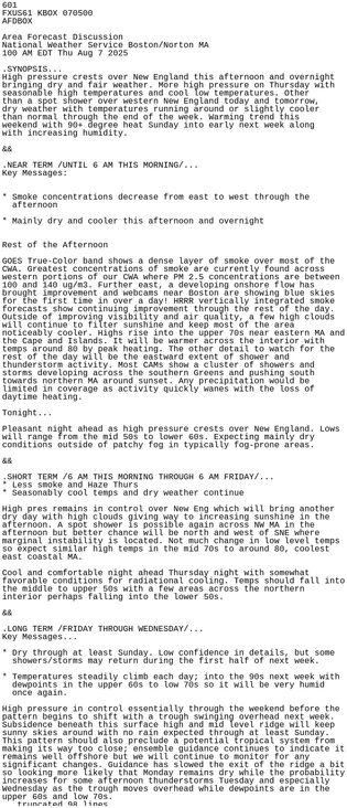
photog.social is one of the many independent Mastodon servers you can use to participate in the fediverse.
A place for your photos and banter. Photog first is our motto Please refer to the site rules before posting.

Administered by:

Server stats:

245
active users

#box

9 posts3 participants0 posts today

#BOX #MAwx 607
FXUS61 KBOX 150651
AFDBOX

Area Forecast Discussion
National Weather Service Boston/Norton MA
251 AM EDT Fri Aug 15 2025

.SYNOPSIS...

High pressure building into the region will bring lower humidity and
seasonable temperatures today and Saturday. The heat and humidity
briefly returns Sunday along with the risk for a few showers and
thunderstorms during the afternoon and evening as a cold front
crosses the region. This front will usher in cooler/bel mesonet.agron.iastate.edu/p.ph

mesonet.agron.iastate.eduIEM :: AFD from NWS BOXAFD issued by NWS BOX at 15 Aug 2025 06:51 UTC

#BOX #MAwx 899
WGUS71 KBOX 140035
FFSBOX

Flash Flood Statement
National Weather Service Boston/Norton MA
835 PM EDT Wed Aug 13 2025

MAC009-017-140045-
/O.CAN.KBOX.FF.W.0016.000000T0000Z-250814T0100Z/
/00000.0.ER.000000T0000Z.000000T0000Z.000000T0000Z.OO/
Essex MA-Middlesex MA-
835 PM EDT Wed Aug 13 2025

...FLASH FLOOD WARNING IS CANCELLED FOR NORTHWESTERN ESSEX AND
NORTHEASTERN MIDDLESEX COUNTIES...

The heavy rain has ended. Flooding is no longer expected to pose mesonet.agron.iastate.edu/vtec

Iowa Environmental MesonetKBOX Flash Flood Warning #16Essex, Middlesex

#BOX #MAwx 055
WGUS71 KBOX 140013
FFSBOX

Flash Flood Statement
National Weather Service Boston/Norton MA
813 PM EDT Wed Aug 13 2025

MAC009-017-140100-
/O.CON.KBOX.FF.W.0016.000000T0000Z-250814T0100Z/
/00000.0.ER.000000T0000Z.000000T0000Z.000000T0000Z.OO/
Essex MA-Middlesex MA-
813 PM EDT Wed Aug 13 2025

...FLASH FLOOD WARNING REMAINS IN EFFECT UNTIL 9 PM EDT THIS EVENING
FOR NORTHWESTERN ESSEX AND NORTHEASTERN MIDDLESEX COUNTIES...

At 813 PM EDT, Doppler radar ind mesonet.agron.iastate.edu/vtec

Iowa Environmental MesonetKBOX Flash Flood Warning #16Essex, Middlesex

#BOX #MAwx 183
WWUS51 KBOX 132124
SVSBOX

Severe Weather Statement
National Weather Service Boston/Norton MA
524 PM EDT Wed Aug 13 2025

MAC009-017-132134-
/O.EXP.KBOX.SV.W.0056.000000T0000Z-250813T2130Z/
Essex MA-Middlesex MA-
524 PM EDT Wed Aug 13 2025

...THE SEVERE THUNDERSTORM WARNING FOR WEST CENTRAL ESSEX AND
NORTHEASTERN MIDDLESEX COUNTIES WILL EXPIRE AT 530 PM EDT...

The storm which prompted the warning has moved out of the area.
Therefore, the warning will b mesonet.agron.iastate.edu/vtec

Iowa Environmental MesonetKBOX Severe Thunderstorm Warning #56Essex, Worcester, Middlesex

#BOX #MAwx 020
WGUS51 KBOX 132103
FFWBOX
CTC003-013-MAC013-140015-
/O.NEW.KBOX.FF.W.0015.250813T2103Z-250814T0015Z/
/00000.0.ER.000000T0000Z.000000T0000Z.000000T0000Z.OO/

BULLETIN - EAS ACTIVATION REQUESTED
Flash Flood Warning
National Weather Service Boston/Norton MA
503 PM EDT Wed Aug 13 2025

The National Weather Service in Norton has issued a

* Flash Flood Warning for...
Northern Hartford County in northern Connecticut...
Western Tolland County in northern Co mesonet.agron.iastate.edu/vtec

Iowa Environmental MesonetKBOX Flash Flood Warning #15Hartford, Tolland, Hampden

#BOX #MAwx 242
WUUS51 KBOX 132100
SVRBOX
CTC003-013-015-MAC013-027-132200-
/O.NEW.KBOX.SV.W.0057.250813T2100Z-250813T2200Z/

BULLETIN - IMMEDIATE BROADCAST REQUESTED
Severe Thunderstorm Warning
National Weather Service Boston/Norton MA
500 PM EDT Wed Aug 13 2025

The National Weather Service in Boston/Norton has issued a

* Severe Thunderstorm Warning for...
Western Windham County in northern Connecticut...
Tolland County in northern Connecticut...
Hartford Count mesonet.agron.iastate.edu/vtec

Iowa Environmental MesonetKBOX Severe Thunderstorm Warning #57Hartford, Tolland, Windham, Hampden, Worcester

#BOX #MAwx 458
AWUS01 KWNH 132059
FFGMPD
CTZ000-NYZ000-NJZ000-PAZ000-DEZ000-MDZ000-VAZ000-DCZ000-WVZ000-OHZ000-140255-

Mesoscale Precipitation Discussion 0929
NWS Weather Prediction Center College Park MD
455 PM EDT Wed Aug 13 2025

Areas affected...Portions of the Central Appalachians and into the
Central/Northern Mid-Atlantic and Southern New England

Concerning...Heavy rainfall...Flash flooding likely

Valid 132055Z - 140255Z

SUMMARY...Clusters of heavy showers an wpc.ncep.noaa.gov/metwatch/met

www.wpc.ncep.noaa.govWPC Met Watch

#BOX #MAwx 520
WUUS51 KBOX 132037
SVRBOX
MAC009-017-027-132130-
/O.NEW.KBOX.SV.W.0056.250813T2037Z-250813T2130Z/

BULLETIN - IMMEDIATE BROADCAST REQUESTED
Severe Thunderstorm Warning
National Weather Service Boston/Norton MA
437 PM EDT Wed Aug 13 2025

The National Weather Service in Boston/Norton has issued a

* Severe Thunderstorm Warning for...
West central Essex County in northeastern Massachusetts...
Northeastern Worcester County in central Massachusetts...
mesonet.agron.iastate.edu/vtec

Iowa Environmental MesonetKBOX Severe Thunderstorm Warning #56Essex, Worcester, Middlesex

#BOX #MAwx 169
AEUS71 KBOX 130338
AQABOX

Air Quality Alert Message
Relayed by National Weather Service Boston/Norton MA
1138 PM EDT Tue Aug 12 2025

CTZ002-140315-
Hartford CT-
Including the cities of Hartford and Windsor Locks
1138 PM EDT Tue Aug 12 2025

...AIR QUALITY ALERT IN EFFECT FROM 11 AM TO 11 PM EDT WEDNESDAY...

The Connecticut Department of Environmental Protection has issued an
Air Quality Action Day for Ground Level Ozone, from 11 AM to 11 PM
EDT Wednes mesonet.agron.iastate.edu/p.ph

mesonet.agron.iastate.eduIEM :: AQA from NWS BOXAQA issued by NWS BOX at 13 Aug 2025 03:38 UTC

#BOX #MAwx 601
FXUS61 KBOX 070500
AFDBOX

Area Forecast Discussion
National Weather Service Boston/Norton MA
100 AM EDT Thu Aug 7 2025

.SYNOPSIS...
High pressure crests over New England this afternoon and overnight
bringing dry and fair weather. More high pressure on Thursday with
seasonable high temperatures and cool low temperatures. Other
than a spot shower over western New England today and tomorrow,
dry weather with temperatures running around or slightly cool mesonet.agron.iastate.edu/p.ph

mesonet.agron.iastate.eduIEM :: AFD from NWS BOXAFD issued by NWS BOX at 07 Aug 2025 05:00 UTC

#BOX #MAwx 357
FXUS61 KBOX 042351
AFDBOX

Area Forecast Discussion
National Weather Service Boston/Norton MA
751 PM EDT Mon Aug 4 2025

.SYNOPSIS...
Dry weather, seasonable temperatures, and moderate relative
humidity expected to continue through the week. Wildfire smoke
lingers into Tuesday, but may not be as noticeable. Our next
chance for rain may not materialize until next Sunday.

&&

.NEAR TERM /THROUGH TUESDAY/...
Key Messages:

* Haze from Canadian wildfire mesonet.agron.iastate.edu/p.ph

mesonet.agron.iastate.eduIEM :: AFD from NWS BOXAFD issued by NWS BOX at 04 Aug 2025 23:51 UTC

alojapan.com/1335812/japan-min Japan Ministry of Defense’s Air Self-Defense Force Powers Cloud Content Management with Box #ASDF #Box #GovernmentInformationSystems #Japan #JapanNews #JapanTopics #MinistryOfDefense #news #SelfDefenseForce #USAirForce TOKYO, August 01, 2025–(BUSINESS WIRE)–Box, Inc. (NYSE: BOX), the leading Intelligent Content Management (ICM) platform, today announced that the Japan Ministry of Defense’s Air Self-Defense Force (ASDF) has selected and

#BOX #MAwx 617
WGUS61 KBOX 301808
FFABOX

URGENT - IMMEDIATE BROADCAST REQUESTED
Flood Watch
National Weather Service Boston/Norton MA
208 PM EDT Wed Jul 30 2025

CTZ002>004-310715-
/O.NEW.KBOX.FA.A.0007.250731T1800Z-250801T1800Z/
/00000.0.ER.000000T0000Z.000000T0000Z.000000T0000Z.OO/
Hartford CT-Tolland CT-Windham CT-
Including the cities of Union, Hartford, Putnam, Willimantic,
Vernon, and Windsor Locks
208 PM EDT Wed Jul 30 2025

...FLOOD WATCH IN EFFECT FROM THURSD mesonet.agron.iastate.edu/vtec

Iowa Environmental MesonetKBOX Flood Watch #7Hartford, Tolland, Windham

#BOX #MAwx 435
FXUS61 KBOX 260820
AFDBOX

Area Forecast Discussion
National Weather Service Boston/Norton MA
420 AM EDT Sat Jul 26 2025

.SYNOPSIS...
Showers and areas of severe thunderstorms continue this
afternoon with a cold front. Cooler and mainly dry Saturday
with showers and thunderstorms returning for Sunday. Outlook for
early next week shows summerlike warmth and humidity, with
generally dry weather for the majority of the time. Showers and
thunderstorms r mesonet.agron.iastate.edu/p.ph

mesonet.agron.iastate.eduIEM :: AFD from NWS BOXAFD issued by NWS BOX at 26 Jul 2025 08:20 UTC

#BOX #MAwx 893
FXUS61 KBOX 260555
AFDBOX

Area Forecast Discussion
National Weather Service Boston/Norton MA
155 AM EDT Sat Jul 26 2025

.SYNOPSIS...
Showers and areas of severe thunderstorms continue this
afternoon with a cold front. Cooler and mainly dry Saturday
with showers and thunderstorms returning for Sunday. Outlook for
early next week shows summerlike warmth and humidity, with
generally dry weather for the majority of the time. Showers and
thunderstorms r mesonet.agron.iastate.edu/p.ph

mesonet.agron.iastate.eduIEM :: AFD from NWS BOXAFD issued by NWS BOX at 26 Jul 2025 05:55 UTC

#BOX #MAwx 748
WWUS61 KBOX 252057
WCNBOX

WATCH COUNTY NOTIFICATION FOR WATCH 542
NATIONAL WEATHER SERVICE BOSTON/NORTON MA
457 PM EDT FRI JUL 25 2025

CTC003-013-015-MAC001-005-007-013-015-019-021-023-025-027-RIC001-
003-005-007-009-252200-
/O.CAN.KBOX.SV.A.0542.000000T0000Z-250726T0100Z/

THE NATIONAL WEATHER SERVICE HAS CANCELLED SEVERE THUNDERSTORM
WATCH 542 FOR THE FOLLOWING AREAS

IN CONNECTICUT THIS CANCELS 3 COUNTIES

IN NORTHERN CONNECTICUT

HARTFORD mesonet.agron.iastate.edu/vtec

Iowa Environmental MesonetKBOX Severe Thunderstorm Watch #542Boston Harbor, Nantucket Sound, Vineyard Sound, Buzzards Bay, Rhode Island Sound, Narragansett Bay, Block Island Sound, Hartford, Tolland, Windham, Barnstable, Bristol, Dukes, Hampden, Hampshire, Nantucket, Norfolk, Plymouth, Suffolk, Worcester, Bristol, Kent, Newport, Providence, Washington

#BOX #MAwx 356
WWUS51 KBOX 252010
SVSBOX

Severe Weather Statement
National Weather Service Boston/Norton MA
410 PM EDT Fri Jul 25 2025

MAC023-252020-
/O.EXP.KBOX.SV.W.0053.000000T0000Z-250725T2015Z/
Plymouth MA-
410 PM EDT Fri Jul 25 2025

...THE SEVERE THUNDERSTORM WARNING FOR SOUTHERN PLYMOUTH COUNTY WILL
EXPIRE AT 415 PM EDT...

The storm which prompted the warning has moved out of the area.
Therefore, the warning will be allowed to expire.

A Severe Thunderstorm mesonet.agron.iastate.edu/vtec

Iowa Environmental MesonetKBOX Severe Thunderstorm Warning #53Plymouth, Bristol

#BOX #MAwx 546
WWUS51 KBOX 251912
SVSBOX

Severe Weather Statement
National Weather Service Boston/Norton MA
312 PM EDT Fri Jul 25 2025

MAC021-027-251921-
/O.CAN.KBOX.SV.W.0052.000000T0000Z-250725T1945Z/
Worcester MA-Norfolk MA-
312 PM EDT Fri Jul 25 2025

...THE SEVERE THUNDERSTORM WARNING FOR SOUTHEASTERN WORCESTER AND
SOUTHWESTERN NORFOLK COUNTIES IS CANCELLED...

The storms which prompted the warning have moved out of the warned
area. Therefore, the warning has b mesonet.agron.iastate.edu/vtec

Iowa Environmental MesonetKBOX Severe Thunderstorm Warning #52Kent, Norfolk, Worcester, Bristol, Plymouth, Bristol, Providence