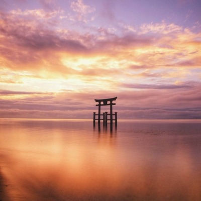
https://www.alojapan.com/1314406/japans-shonan-coast-goes-luxe-with-boutique-hotels/ Japan’s Shonan coast goes luxe with boutique hotels #Boutique #coast #goes #hotels #JapanTrips #Japans #luxe #Shonan #trips YOKOHAMA, Japan — The Shonan coast southwest of Tokyo is quietly evolving from a casual respite from the big city into a luxury weekend hideaway as chic boutique hotels pop up across the area. With sweeping views of Mount Fuji and Enoshima across Sagami Bay — and the cachet of seaside enclaves like Zushi and Hayama…

#Goes
0 posts0 participants0 posts today


#KunstImÖffentlichenRaum
Eine Wand in #Goes,NL
https://www.alojapan.com/1284218/salvador-illa-is-negotiating-a-direct-barcelona-tokyo-flight-taking-advantage-of-his-tour-of-japan/ Salvador Illa is negotiating a direct Barcelona-Tokyo flight, taking advantage of his tour of Japan. #catalonia #goes #illa #Japan #Salvador #seduce #to #Tokyo #TokyoTopics #tour #with #東京 #東京都 TokyoJapan is the destination of the first intercontinental trip for the President of the Generalitat (Catalan government), Salvador Illa. The Catalan leader arrives in Tokyo this Monday to begin a week-long tour of four Japanese cities, culminating in…
Net een ritje gemaakt van #Vlissingen naar #Goes in een Fiat #Panda. Een echte, jaren '80, niet zo'n moderne lookalike.
Wat is dat toch een leuk bakkie, super eenvoudig en spartaans. Hij haalt 100 op de snelweg, en wat heb je eigenlijk meer nodig?
Hij zou elektrisch moeten zijn, schoner en stiller, maar dan zou dat model wat mij betreft zo weer op de markt mogen.
Wat is dat toch een leuk bakkie, super eenvoudig en spartaans. Hij haalt 100 op de snelweg, en wat heb je eigenlijk meer nodig?
Hij zou elektrisch moeten zijn, schoner en stiller, maar dan zou dat model wat mij betreft zo weer op de markt mogen.
social.woefdram.nlSocial.woefdram.nl


NO OTHER LAND - Officiële Nederlandse #trailer - #Filmladder
https://www.youtube.com/watch?v=WBi-VStZWNI
De winnaar van Oscar voor beste documentaire is volgens mij nog niet online te zien, maar wel in #filmtheaters in de volgende steden: #Amsterdam #Breda #DenHaag #Deventer #Eindhoven #Goes #Gouda #Groningen #Maastricht #Utrecht
No Other Land | #bioscoop | tijden
https://www.filmladder.nl/film/no-other-land-2024/bioscopen
/2

Anyone know of any efforts to archive GOES satellite data outside the US, now that NOAA's funding is under threat?
Low pressure system over the Great Lakes right now (!) #swirly #goes #satellite

Kirche St. Maria Magdalena
Römisch-katholisches Kirchengebäude in Goes - Zeeland - Niederlande
Hurricane Milton as of 10/07/24 11:23am PT #Milton #HurricaneMilton #GOES
Lots of stuff burning today in SoCal. #wildfires #satellites #RemoteImaging #GOES
Ying Yang Beryl #TSBeryl #satellite #RemoteImaging #GOES
Continued thread

#NOAA’s #GOESU #weather #satellite is scheduled to launch Tues evening from #NASA’s Kennedy #Space Center, extending a decades-long record of terrestrial weather & #solar observations as part of NOAA’s #GOES program.
NOAA’s GOES program is probably best known for providing advanced imagery & measurements of the western hemisphere’s weather, #atmosphere, #oceans & #lightning. The info is critical in helping weather forecasters ID & track events, like #hurricanes & #wildfires.

NASA and SpaceX now are targeting Tuesday, June 25, for the launch of #GOES-U, the fourth and final satellite in the Geostationary Operational Environmental Satellites (GOES) – R Series: https://www.nesdis.noaa.gov/news/nasa-spacex-target-new-launch-date-noaa-weather-satellite and https://blogs.nasa.gov/goes/. On board is the Compact #Coronagraph-1 (CCOR-1): details in https://ntrs.nasa.gov/api/citations/20230004075/downloads/CCOR_EGUPoster2023.pdf and https://www.goes-r.gov/spacesegment/CCOR.html. Differences from the #LASCO coronagraph on SOHO: https://twitter.com/NOAASatellites/status/1772729162358284734 and https://twitter.com/SungrazerComets/status/1772769416846950655. Where CCOR-2 will go: https://twitter.com/NOAASatellites/status/1772729734054494660
National Environmental Satellite, Data, and Information ServiceNASA, SpaceX Target New Launch Date for NOAA Weather SatelliteNASA and SpaceX now are targeting Tuesday, June 25, for the launch of GOES-U, the fourth and final satellite in the NOAA's GOES – R Series.
Atmospheric River off the coast of California at 7:10am PT via GOES-West satellite. #AtmosphericRiver #CAwx #rain #GOES


Imágenes del satélite GOES 16 donde se aprecia el inicio del eclipse anular
https://www.star.nesdis.noaa.gov/goes/fulldisk_band.php?sat=G16&band=GEOCOLOR&length=12
#Methane on my mind
20y ago, methane concentrations stabilized, giving hope we’d at least addressed one greenhouse gas, but then its concentrations took off again, esp the last 3yrs.
Neat proof of concept pre-print Watine-Guiu, Varon etal :
https://eartharxiv.org/repository/view/5600/
The U.S. Geostationary Operational Environmental Satellite (#GOES) can detect methane leaks, and their geostationary orbit allows them to monitor these leaks, yielding better estimates for volume (provided cloud free skies).

This map always displays the most recent image produced from data collected by the #GOES East satellite. The data is updated every 10 minutes. To see the new image you will need to change to a different basemap and then switch back to the "GOES East color" basemap. #GOESeast
Open #GISsurfer map:
https://mappingsupport.com/p2/gissurfer.php?center=38.308988,-96.152344&zoom=4&basemap=GOES_East_color&overlay=State_boundary&data=https://mappingsupport.com/p2/special_maps/disaster/USA_weather.txt
Continued thread
Wider view. The meteorologists probably can confirm, but I suspect that cloud seen in the middle of the image is related to the jet stream at high elevation somehow. #jetstream #cloud #space #goes #satellite
#GOES East satellite view showing smoke from #Canada #wildfires. New image each 15 minutes but you will need to change to a different basemap and then back to the GOES East basemap to see the new image.
Note - Some of the GIS layers with Canada data are very slow today.
Open #GISsurfer map:
https://mappingsupport.com/p2/gissurfer.php?center=44.643764,-76.640625&zoom=6&basemap=GOES_East_color&overlay=USA_state_boundary,Country&txtfile=https://mappingsupport.com/p2/special_maps/disaster/Canada_wildland_fire.txt